


.png)
GIS data integration
A minimum number of systems with maximum output. That is an ideal IT landscape. Practice is more recalcitrant. A geographic information system can do a lot, but not everything. Good data integration with non-spatial software is therefore absolutely essential to keep your critical business processes running efficiently.
ArcGIS is the most comprehensive geographic information system on the market. Safe Software's FME is, in our experience, the best data integration platform for geographic applications. Tensing combines the power of both software packages to achieve maximum results. Need immediate help optimising your GIS data integration? Schedule a no-obligation appointment with our specialist below!

Setting up a good data integration process
Setting up a good data integration process is a painstaking job. The process is not finished after the initial configuration. Consistent action in relation to data ensures lasting quality. In addition, documentation is vital. Data managers inside and possibly outside your organisation need to understand very well what your data rules are. In our experience, high data awareness ensures a structural improvement of data quality within your organisation.
Text continues below image.

The great strength of Tensing is that our consultants act very consistently and embrace the same mindset. This is mainly due to our intensive investment in knowledge exchange, which is deep in our DNA. Once a month, we learn from each other during knowledge sessions. Sharing our knowledge with customers is also a goal for us. We like to make customers self-reliant and thus make ourselves redundant.
Best practice GIS data integration
Good data integration is indispensable for organisations with a role in outdoor space management. The efficiency of management processes can be vastly improved with the help of advanced data integration. The Gis as a Service (GAAS) project we completed with our partner CGI at ProRail shows how advanced data integration delivers efficiency gains. Watch the webinar we recorded with ProRail on this best practice!
This might also interest you
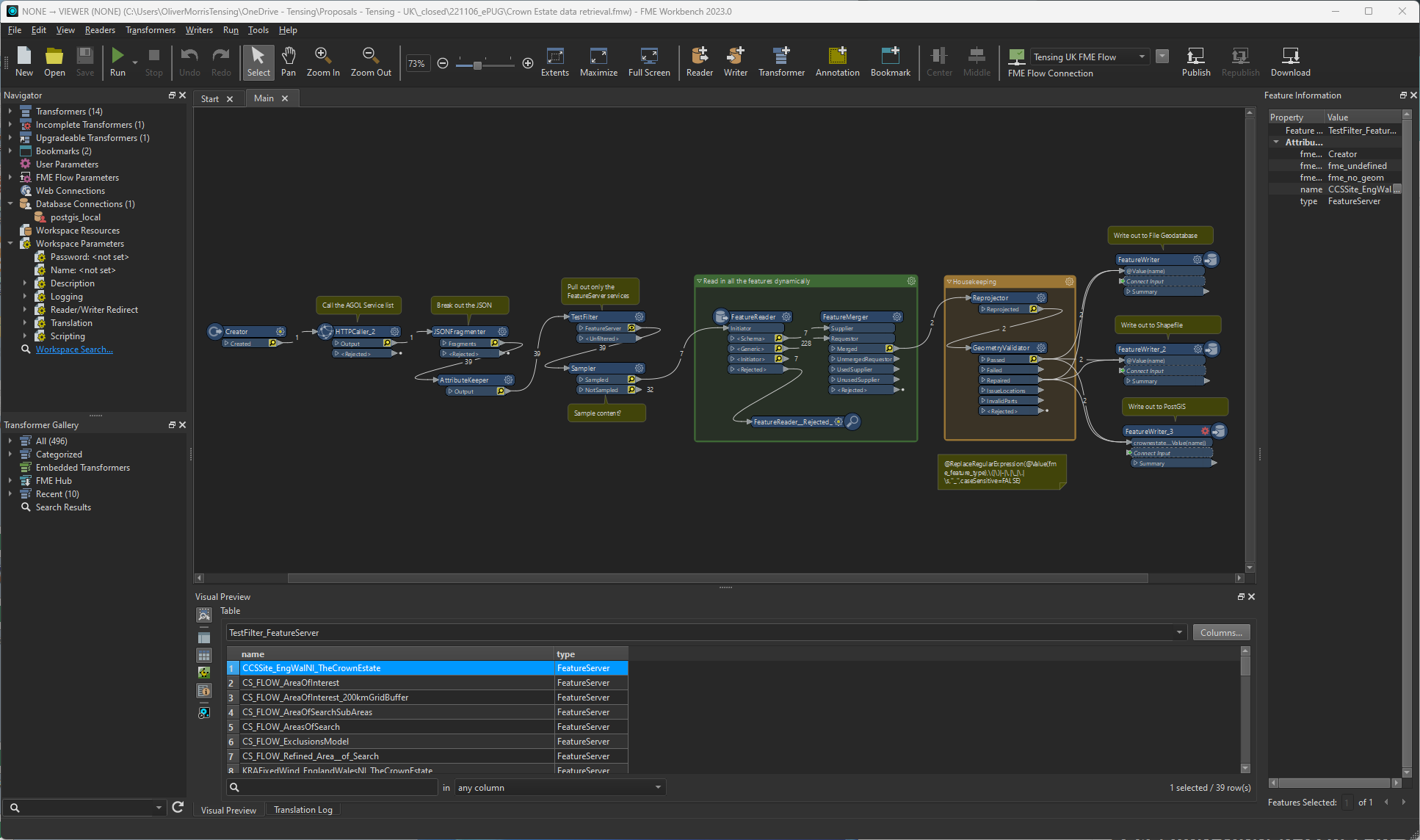
Revealing Hidden Issues in Spatial Data with FME
Business Director Oliver Morris dives deeply into the importance of geometry validation when working with spatial data.
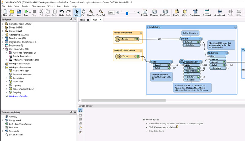
Low-Code/No-Code: Unleashing the Power of FME
Having an efficient and flexible system for data extraction, translation, and loading (ETL) is essential to keep your data pipelines running smoothly.
